Using Airborne LiDAR to Measure Rubber Tree Characteristics and Carbon Storage

Jenn Hoskins
25th August, 2025

Using Airborne LiDAR to Measure Rubber Tree Characteristics and Carbon Storage

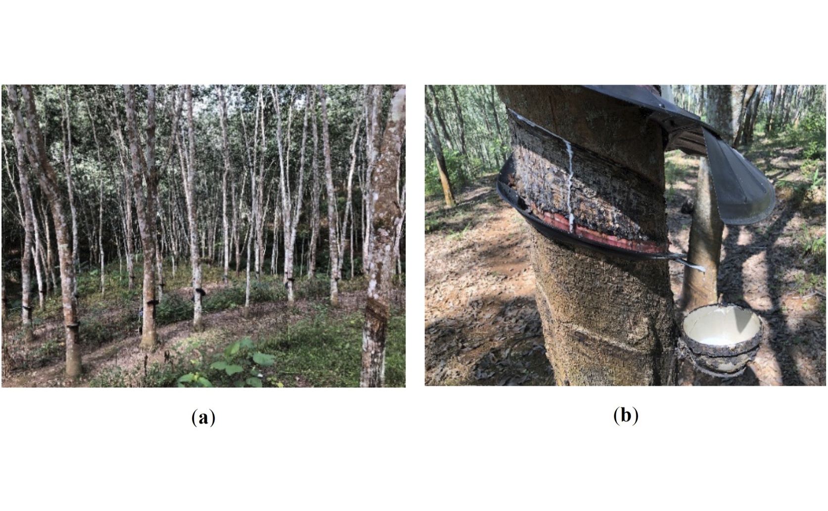
Artificial rubber tree (Hevea brasiliensis) plantations (a) serve as substantial forestry carbon sinks quantified in this study, providing key ecological benefits alongside the economic value of latex production (b).

Image adapted from: Tai et al. / CC BY (Source)

Key Findings

  • This study, conducted in Yunnan Province, China, used drone-based LiDAR to improve carbon stock calculations in rubber plantations
  • Direct point cloud segmentation proved most accurate for identifying individual rubber trees within the LiDAR data
  • A new model estimating tree diameter at breast height (DBH) from east-west crown diameter data enabled accurate carbon stock estimation of 278,602.17 kg in the study area
Forests are increasingly recognized as crucial tools in combating climate change, largely due to their ability to absorb carbon dioxide from the atmosphere – a process known as carbon sequestration. Accurately measuring the amount of carbon stored within forests, and tracking changes in that storage, is essential for carbon trading schemes and verifying the effectiveness of climate mitigation efforts. Rubber plantations, offering both ecological and economic advantages, represent a significant potential carbon sink, but efficiently assessing their carbon stock has been a persistent challenge.[1] Researchers at the Yunnan Institute of Water and Hydropower Engineering and Universidade Federal de Uberlandia have recently addressed this challenge, focusing on improving the speed and accuracy of carbon stock calculations in rubber plantations. The core problem lies in obtaining detailed information about the trees themselves. Key measurements include Tree Height (TH) and Diameter at Breast Height (DBH) – the width of the tree trunk at approximately 1.3 meters above the ground. While airborne LiDAR (Light Detection and Ranging) technology is widely used for forest surveys due to its ability to create detailed 3D maps of forest structure, it doesn't directly measure DBH. Traditionally, DBH is measured manually with diameter tapes, a process that is time-consuming and prone to errors. The study tackled this limitation by focusing on the processing of high-resolution LiDAR data. The process began with collecting the LiDAR data, followed by filtering out unwanted noise and identifying the ground level. The critical step involved segmenting the point cloud – essentially isolating individual trees within the 3D data. Four different methods for this segmentation were compared, with the “direct point cloud segmentation” method proving the most accurate in identifying trees. However, identifying trees is only half the battle; DBH still needs to be estimated. The researchers developed a new approach: a linear regression model that predicts DBH based on the tree’s crown diameter. Crown diameter, which can be readily measured from LiDAR data, proved to be a reliable indicator of DBH. This model effectively bridges the gap between readily available LiDAR data and the crucial DBH measurement. This research builds upon earlier work demonstrating the potential of LiDAR technology for carbon sequestration assessments[2]. The study[2] highlighted the accuracy of manual LiDAR measurements compared to traditional methods and automated software, finding a Mean Absolute Percentage Error (MAPE) of 4.276% for manual LiDAR measurements in a rubber forest. The new study takes this a step further by addressing the specific bottleneck of DBH measurement, improving the overall efficiency and precision of the process. Using this refined methodology, the researchers estimated the total biomass in the study area to be 592,770.57 kg, broken down into 550,336.17 kg of aboveground biomass and 42,434.39 kg of belowground biomass. Crucially, they calculated the total carbon stock at 278,602.17 kg. The success of this approach is particularly relevant when considering the complexities of biomass estimation in diverse forest types[3], which emphasizes the importance of local modeling to retain accurate relationships between biomass and environmental variables. The findings also complement research focusing on regression models for estimating aboveground biomass in tropical forests[4], which identified trunk diameter as a key predictor of AGB. The study reinforces this by effectively utilizing crown diameter as a proxy for trunk diameter, streamlining the estimation process with LiDAR data. Furthermore, the use of a linear regression model, similar in principle to those used in[4], demonstrates a practical and robust approach to biomass calculation. The improved accuracy and efficiency achieved in this study have significant implications for forestry carbon sink studies, enabling more reliable carbon accounting and supporting the development of effective carbon trading markets.

AgricultureEnvironmentPlant Science

References

Main Study

1) Extracting rubber tree parameters and estimating carbon storage using airborne LiDAR

Published 22nd August, 2025

https://doi.org/10.1371/journal.pone.0330768


Related Studies

2) Evaluating LiDAR technology for accurate measurement of tree metrics and carbon sequestration.

https://doi.org/10.1016/j.mex.2025.103237


3) Improved aboveground biomass estimation and regional assessment with aerial lidar in California's subalpine forests.

https://doi.org/10.1186/s13021-024-00286-w


4) Tree allometry and improved estimation of carbon stocks and balance in tropical forests.

Journal: Oecologia, Issue: Vol 145, Issue 1, Aug 2005


Related Articles

An unhandled error has occurred. Reload 🗙