How The Land Shaped Sumer
Greg Howard
21st August, 2025


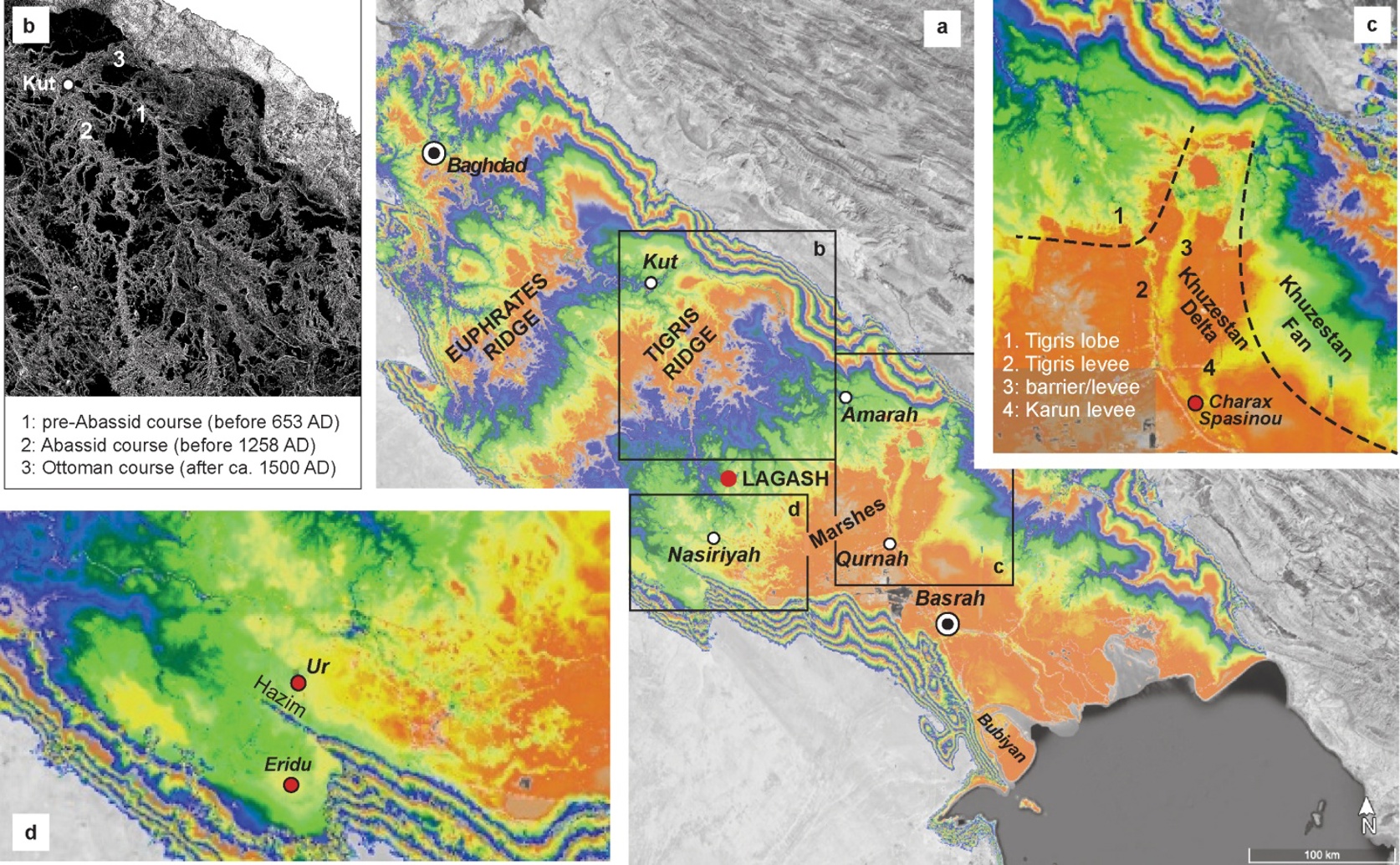
Satellite-derived topography reveals the preservation of distinct large-scale geomorphological zones across the Mesopotamian Plain (a), specifically distinguishing between upstream fluvial avulsion nodes (b) and downstream deltaic or coastal basin features (c, d) that conditioned the evolving hydrological environment of ancient Sumer.
Key Findings
- A study in ancient Mesopotamia reveals that early Sumerian cities thrived due to natural tidal irrigation, where river water pushed inland by tides fertilized fields
- This natural system provided abundant water and nutrients without complex canals, jumpstarting agriculture during a period of stable sea levels
- As the delta grew, tidal access diminished, forcing Sumerians to develop large-scale river irrigation, which shaped their urban society
References
Main Study
1) Morphodynamic Foundations of Sumer
Published 20th August, 2025
https://doi.org/10.1371/journal.pone.0329084
Related Studies
2) Sea level and global ice volumes from the Last Glacial Maximum to the Holocene.
3) Sea level rise impacts on estuarine dynamics: A review.
Related Articles
 15th August, 2025 | Jenn Hoskins