Tracking River Health: From Lab to Satellite with Chlorophyll-a Monitoring
Greg Howard
12th December, 2025


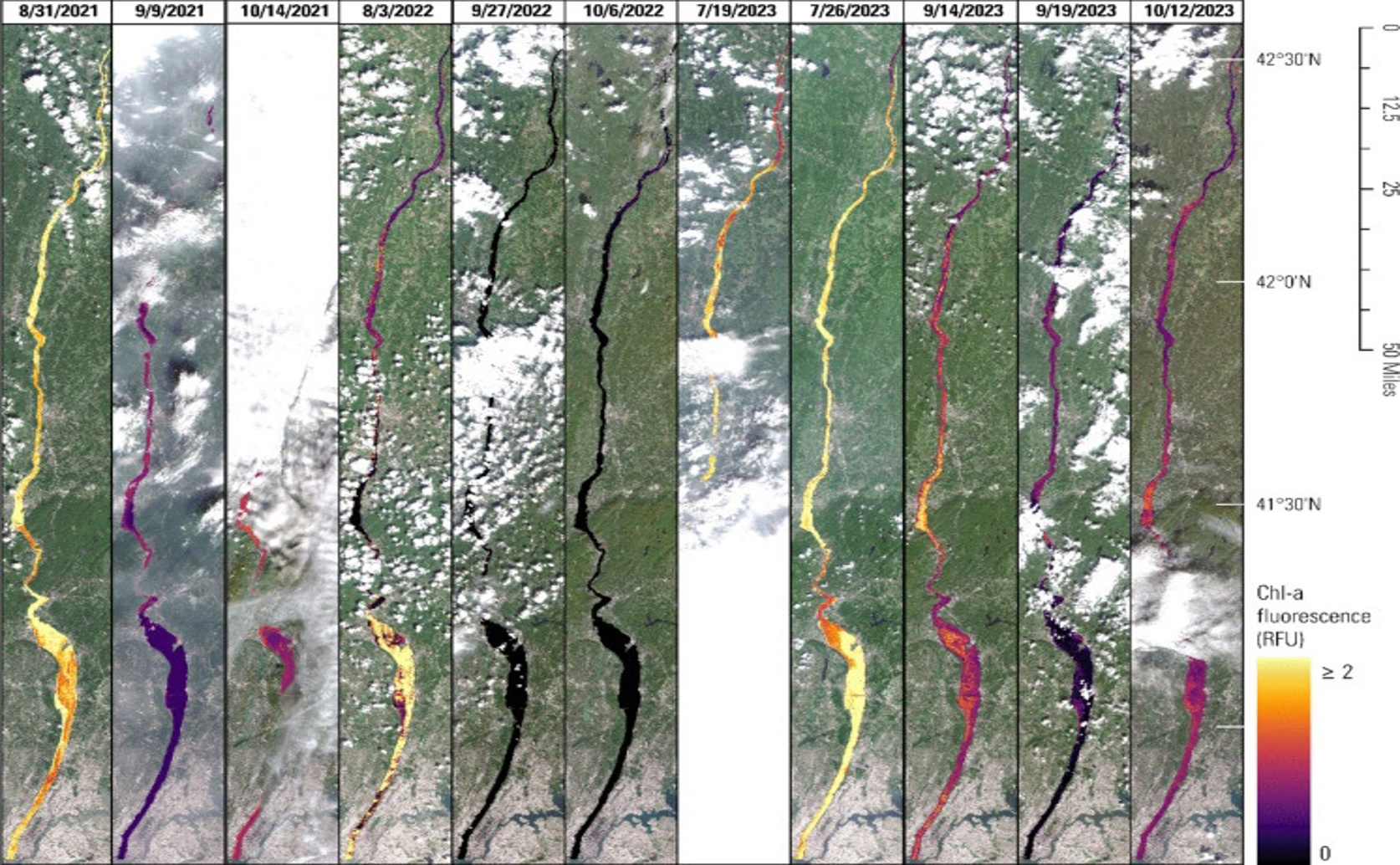
Satellite-derived chlorophyll-a fluorescence in the lower Hudson River shows substantially greater variability across time between survey dates than spatially along the river on any single day.
Key Findings
- This study focused on a 220-kilometer stretch of the lower Hudson River between 2021 and 2023 to improve satellite monitoring of algal blooms
- Laboratory measurements of chlorophyll-a (chl-a) and field-measured chl-a fluorescence showed a weak initial correlation, but this improved when data were analyzed separately for each day
- Machine learning models trained on data from individual days provided the most accurate estimates of chl-a fluorescence, highlighting the importance of accounting for daily changes in river conditions
EnvironmentEcologyOceanography
References
Main Study
1) From sample to sonde to Sentinel-2: insights from a multi-scale chlorophyll-a monitoring effort in the Hudson River, New York
Published 9th December, 2025
https://doi.org/10.1007/s10661-025-14844-3
Related Studies
2) Satellite monitoring of cyanobacterial harmful algal bloom frequency in recreational waters and drinking source waters.
3) The Lake Erie HABs Grab: A binational collaboration to characterize the western basin cyanobacterial harmful algal blooms at an unprecedented high-resolution spatial scale.
4) High-speed limnology: using advanced sensors to investigate spatial variability in biogeochemistry and hydrology.
Related Articles
 9th October, 2025 | Jenn Hoskins