How Land Patterns Affect Neighborhood Air Temperatures in Winter and Summer

Greg Howard
11th August, 2024

How Land Patterns Affect Neighborhood Air Temperatures in Winter and Summer

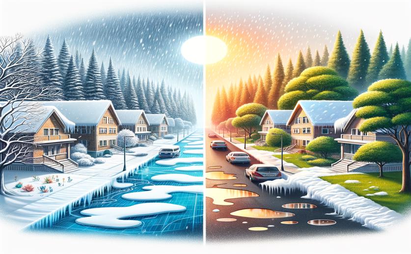
Image Source: Natural Science News, 2024

Key Findings

  • The study in Santiago, Chile, found that neighborhoods with more vegetation, especially trees and shrubs, had lower air temperatures during summer days
  • Built-up areas retained more heat, leading to higher temperatures at night, which worsens the Urban Heat Island (UHI) effect
  • Larger, contiguous green spaces were more effective in reducing air temperatures than smaller, fragmented patches
Understanding the distribution of air temperatures within neighborhoods is crucial for developing strategies to mitigate the adverse effects of urban heat islands (UHI) and climate change. Researchers from Universidad Adolfo Ibáñez have sought to fill a significant knowledge gap regarding the impact of fine resolution landcover patterns on air temperature distribution, considering both temporal and spatial scales[1]. This study is particularly important as it offers insights into how urban planning can be optimized to improve thermal comfort and reduce energy consumption. The study conducted by Universidad Adolfo Ibáñez investigated how different landcover patterns, such as vegetation and built-up areas, influence air temperatures within neighborhoods. The researchers focused on various temporal scales, including seasonal (summer and winter) and daily (diurnal and nocturnal) variations, as well as spatial scales, examining different neighborhood extents. Previous research has shown that urbanization significantly impacts landscape patterns and ecological systems. For instance, a study on the Tabriz metropolitan area demonstrated that urban expansion leads to increased fragmentation and reduced aggregation of ecological lands, contributing to heterogeneous landscape patterns[2]. This fragmentation can exacerbate UHI effects, as fragmented green spaces are less effective in moderating temperatures compared to larger, contiguous green areas. Another relevant study highlighted the role of urban greenspaces in mitigating UHI effects by reducing surface temperature extremes. It was found that trees and shrubs in non-domestic greenspaces significantly reduced mean maximum daily soil surface temperatures during summer[3]. This finding underscores the importance of vegetation in urban areas for temperature regulation. The current study by Universidad Adolfo Ibáñez builds on these earlier findings by examining the effects of fine resolution landcover patterns on air temperatures within neighborhoods. The researchers employed high-resolution satellite imagery and temperature sensors to capture detailed landcover and temperature data. They analyzed how different landcover types, such as trees, shrubs, grasslands, and built-up areas, influence air temperatures during different times of the day and seasons. The findings revealed that landcover patterns have a significant impact on air temperature distribution. During summer, neighborhoods with higher vegetation cover, particularly trees and shrubs, experienced lower air temperatures compared to areas dominated by built-up surfaces. This effect was more pronounced during the day when solar radiation is at its peak. Conversely, built-up areas retained more heat, leading to higher nocturnal temperatures, which can exacerbate the UHI effect. In winter, the presence of vegetation also influenced air temperatures, but the effects were less pronounced compared to summer. Trees and shrubs tended to maintain slightly higher temperatures during winter, providing a moderating effect on the cold. This aligns with previous findings that trees in domestic gardens, which are typically smaller, are less effective at reducing summer soil surface temperatures but can help maintain warmth during colder months[3]. The study also highlighted the importance of spatial scale in understanding temperature distribution. Larger contiguous greenspaces were more effective in reducing air temperatures than smaller, fragmented patches. This finding supports the notion that urban planning should prioritize the creation and maintenance of large green areas to maximize their cooling benefits. In conclusion, the research conducted by Universidad Adolfo Ibáñez provides valuable insights into how fine resolution landcover patterns influence air temperature distribution within neighborhoods. By considering both temporal and spatial scales, the study offers a comprehensive understanding of how different landcover types impact thermal comfort in urban areas. These findings underscore the importance of incorporating vegetation, particularly trees and shrubs, in urban planning to mitigate UHI effects and improve the overall livability of cities.

EnvironmentSustainabilityEcology

References

Main Study

1) Effects of landcover fine-scale patterns on neighborhood-level winter and summer nocturnal and diurnal air temperatures

Published 10th August, 2024

https://doi.org/10.1007/s10980-024-01954-5


Related Studies

2) Land use change, urbanization, and change in landscape pattern in a metropolitan area.

https://doi.org/10.1016/j.scitotenv.2018.11.267


3) Soil surface temperatures reveal moderation of the urban heat island effect by trees and shrubs.

https://doi.org/10.1038/srep33708


Related Articles

An unhandled error has occurred. Reload 🗙